Mount June: Let It Snow
Stats
Fitness Level: Moderate (Don't let the short distance fool you)
Experience Level: Easy
Distance: 2.2 Miles
Elevation: 900 Feet
Open: February-December (Weather dependent)
Good for: Day Hiking, Training
Usage: Lightly Traveled
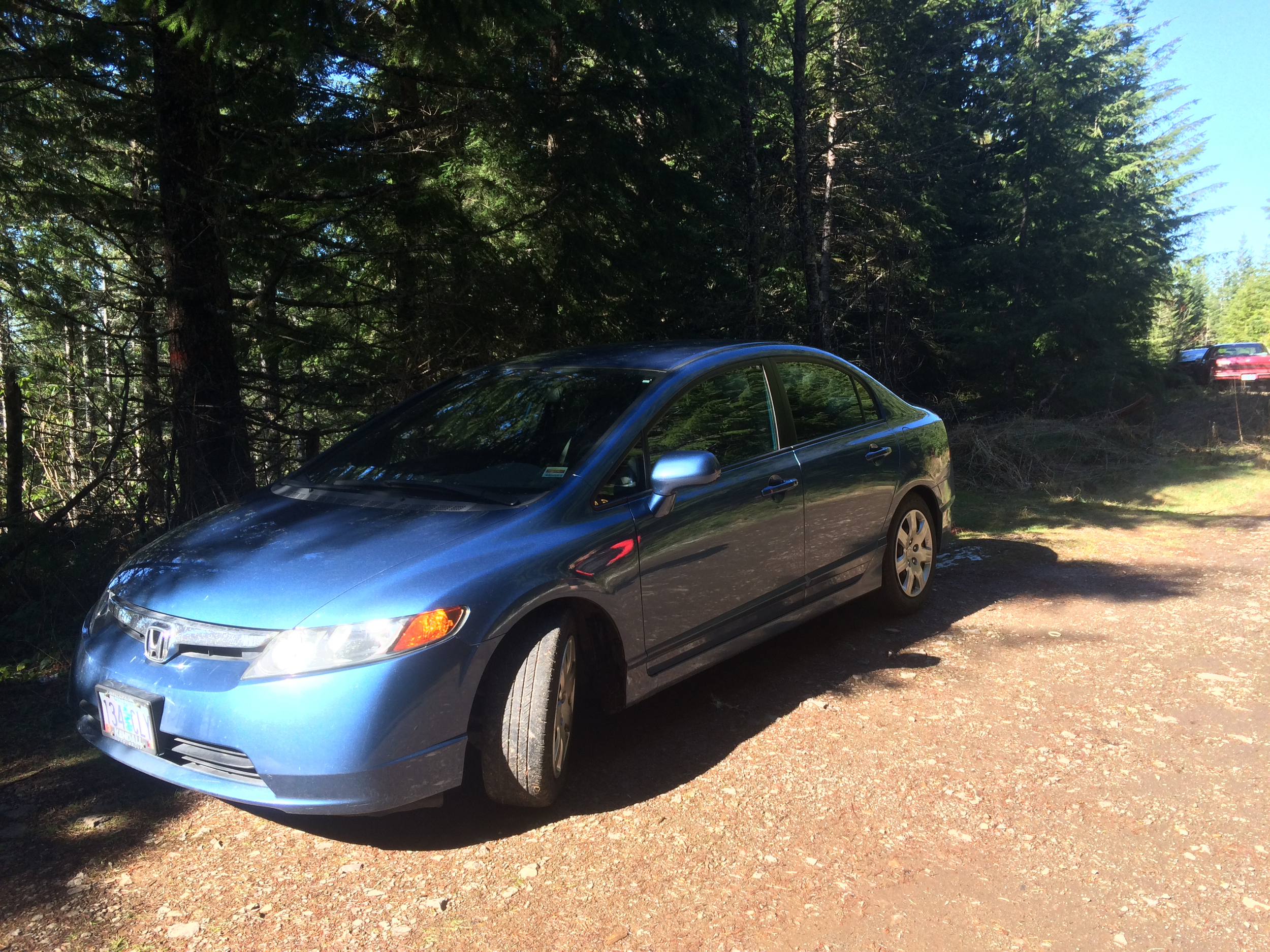
Accessibility: Honda Civic (the last bit of gravel requires some caution)
Quick Take
Mount June is a great option for newer hikers who are in fairly good shape, have conquered Spencer's Butte and Mount Pisgah, and are looking for something a little more adventurous, but not too far out of town.
Trip Report
From everything I have been told about the weather in Oregon, 2015 has been an abnormally warm year. For myself, 40-50 degree days are pretty cold coming from Southern California, but, with the absence of snow that closes down the roads, it's perfect winter hiking weather. So when Dylan and I set out at the end of February to hike Mount June we expected a clear road and a snow free trail, given that it was a "warm" day in Eugene.
The drive out to Mount June is very scenic, with a significant amount of narrow one way roads. The non paved parts feature quite a few potholes, which promptly turn the drive into a game of dodge the ditch while driving up and down the mountain.
Note: Do not mess up at this game, hitting a pothole at speed can cause air bag lights to flicker, or worse the airbag to actually deploy in a non 4 wheel drive vehicle. In all seriousness folks, drive safely up this road!
The road up to Mount June is easily traversed during the summer months, but winter snow and rain take their toll, and maintenance isn’t usually performed by Forest Service until early summer.
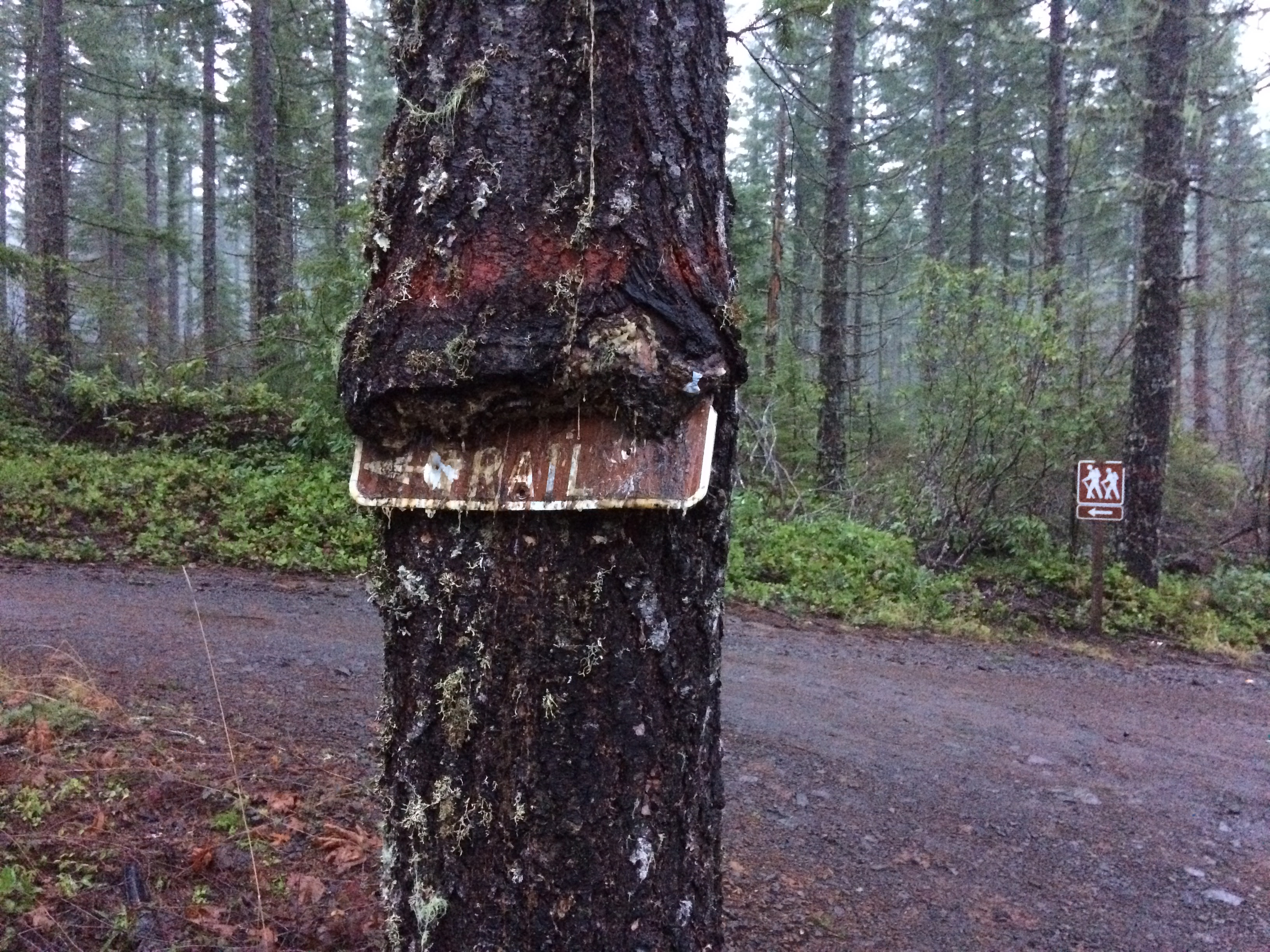
Disappearing signage on the way to Mount June.
Zippy, in her unnatural habitat.
The fallen trail marker.
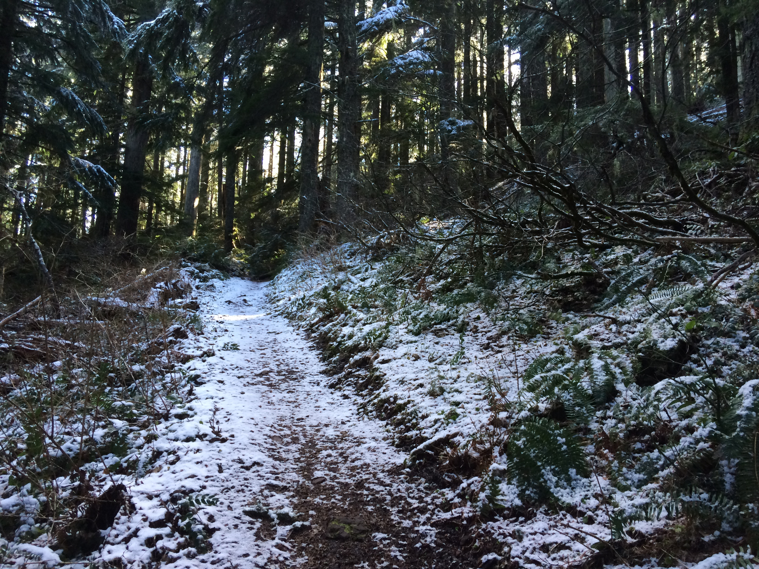
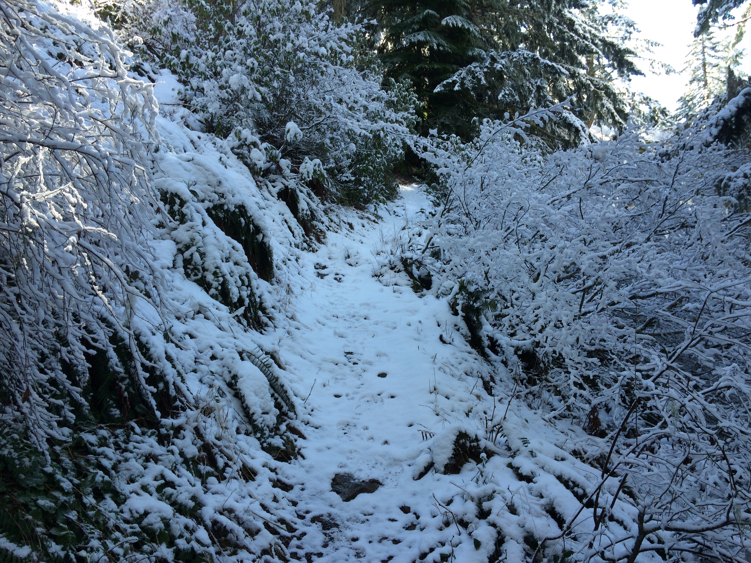
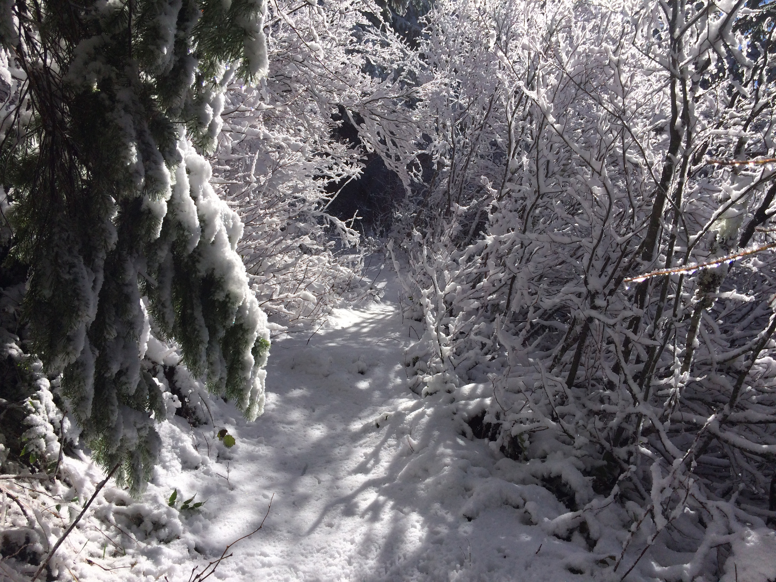
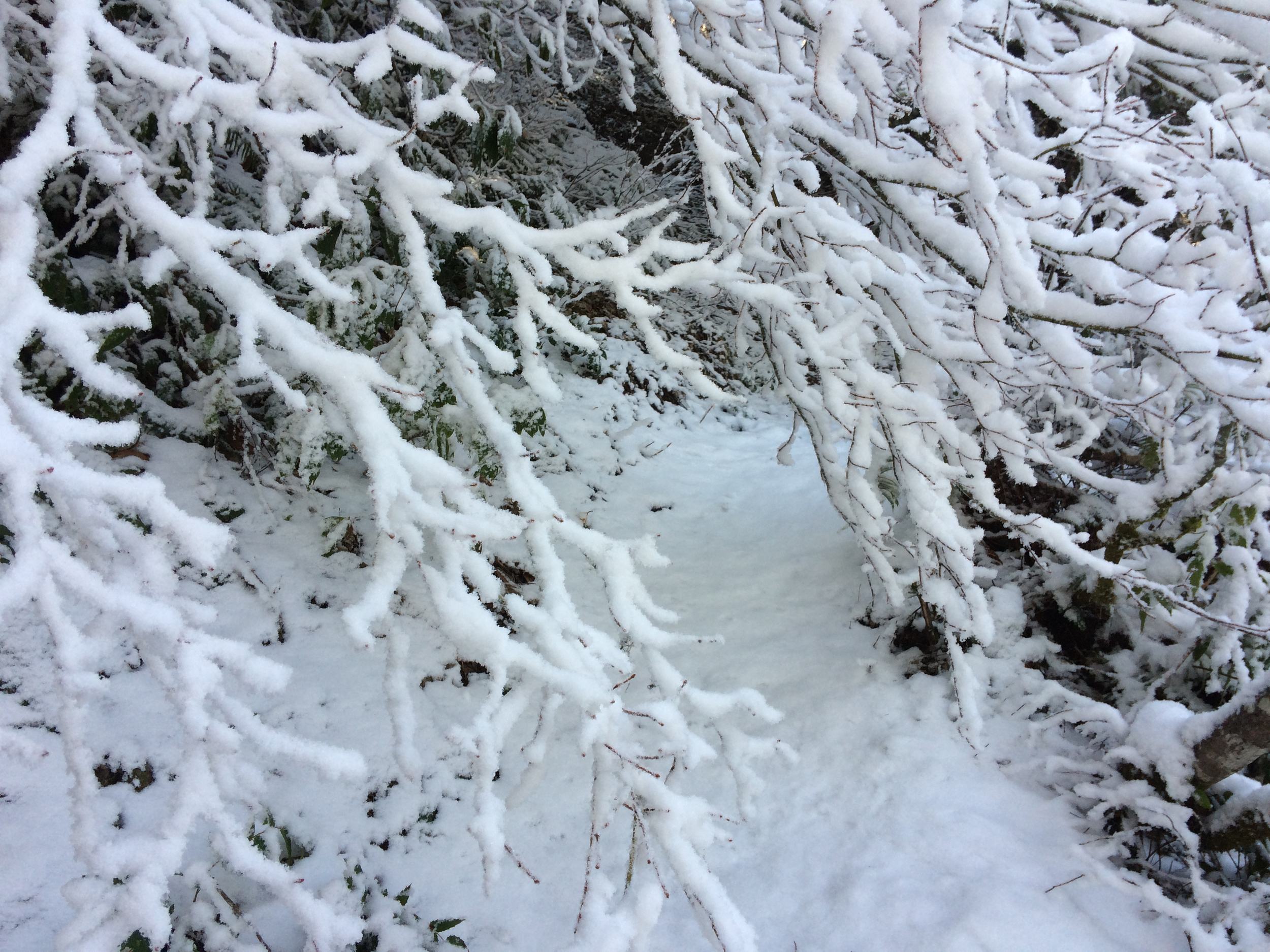
The trail-head is a little break in the forest that’s marked by a fallen post, if you blink, you'll miss it! The first thing we noticed when we got out of the car was that it was drastically colder and the now notorious pot-holes were full of ice and snow! I hadn’t seen snow in a good 10 years and have to admit, my excitement level at seeing it resembled that of a 5 year old. Dylan, mercifully, didn’t tease me too much about it. The first half mile of the hike winds through a lower level forest and is a nice (relatively flat) warm up for the second half of the hike.
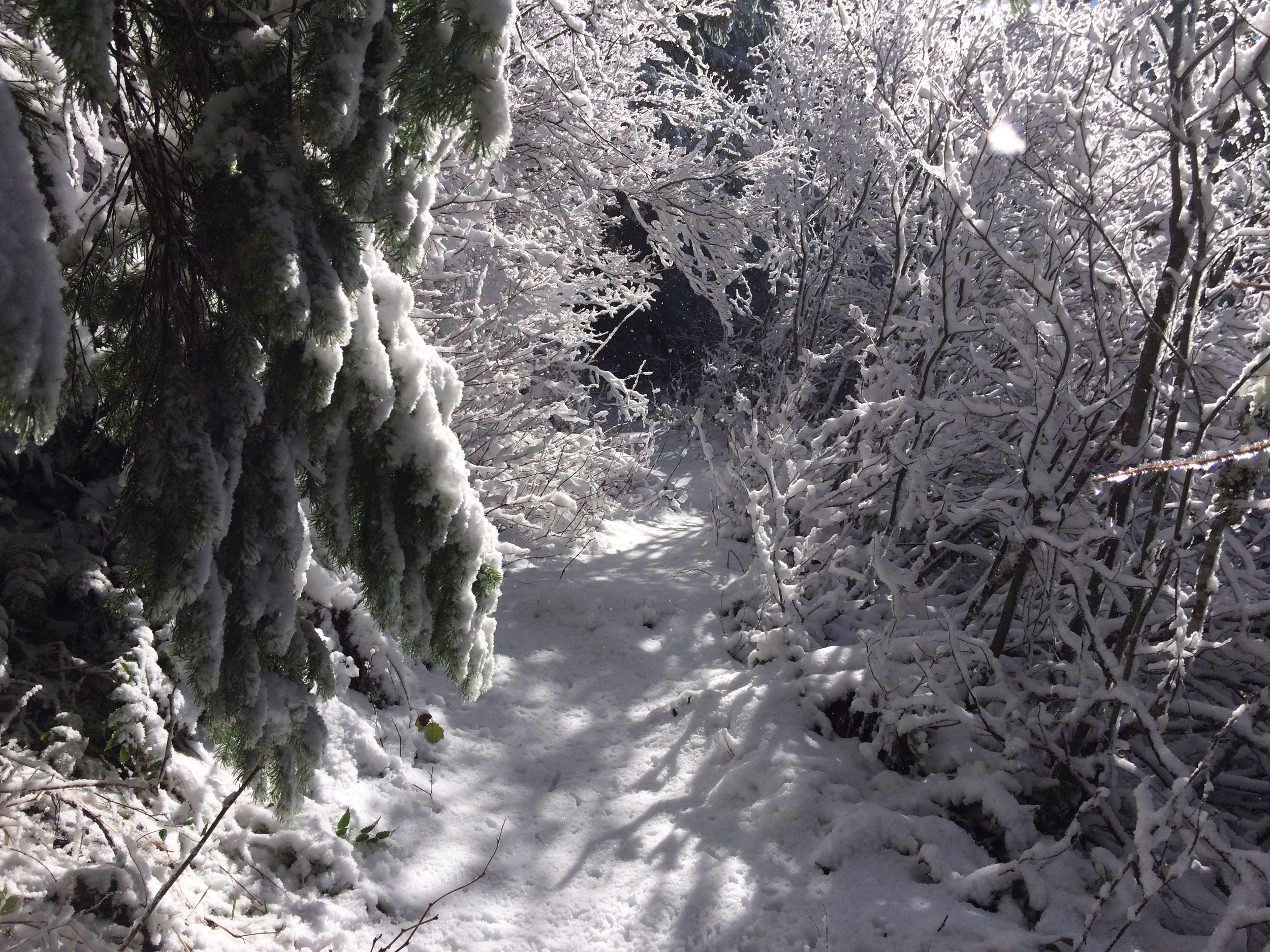
About 5 minutes into the trip we started to see snow cascading down to the forest floor from the tree-tops, giving the illusion that it was snowing on a sunny day. It was ethereally beautiful, cold, and elating; it gave the feeling that you had just stepped into a Christmas wonderland without the claymation. The further up we hiked the thicker the snow got and the more precarious the footing became.
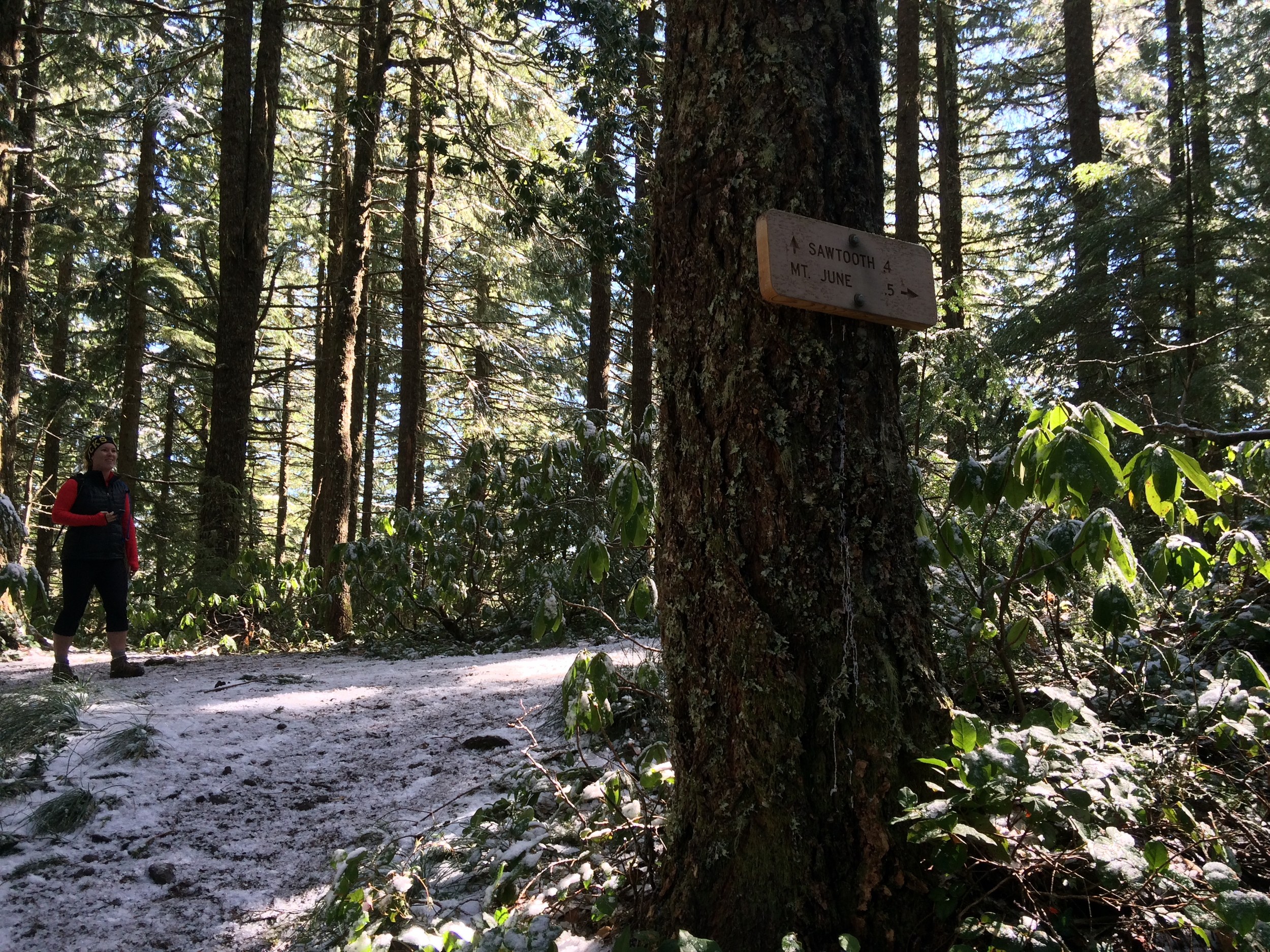
Going right at the trail junction takes you to Mount June, while going straight leads to Sawtooth Rock, and Hardesty Mountain. Be sure to rest up here, this marks the end of the easy section of the hike.
The halfway point provides a great resting spot, and when snow is raining down, ample opportunity to take videos of something truly magical. I cannot emphasize enough the beauty and crispness of sun and gently falling snow in a forest. It will enchant you, and I suggest you take as many moments to savor the peace of it as you can.
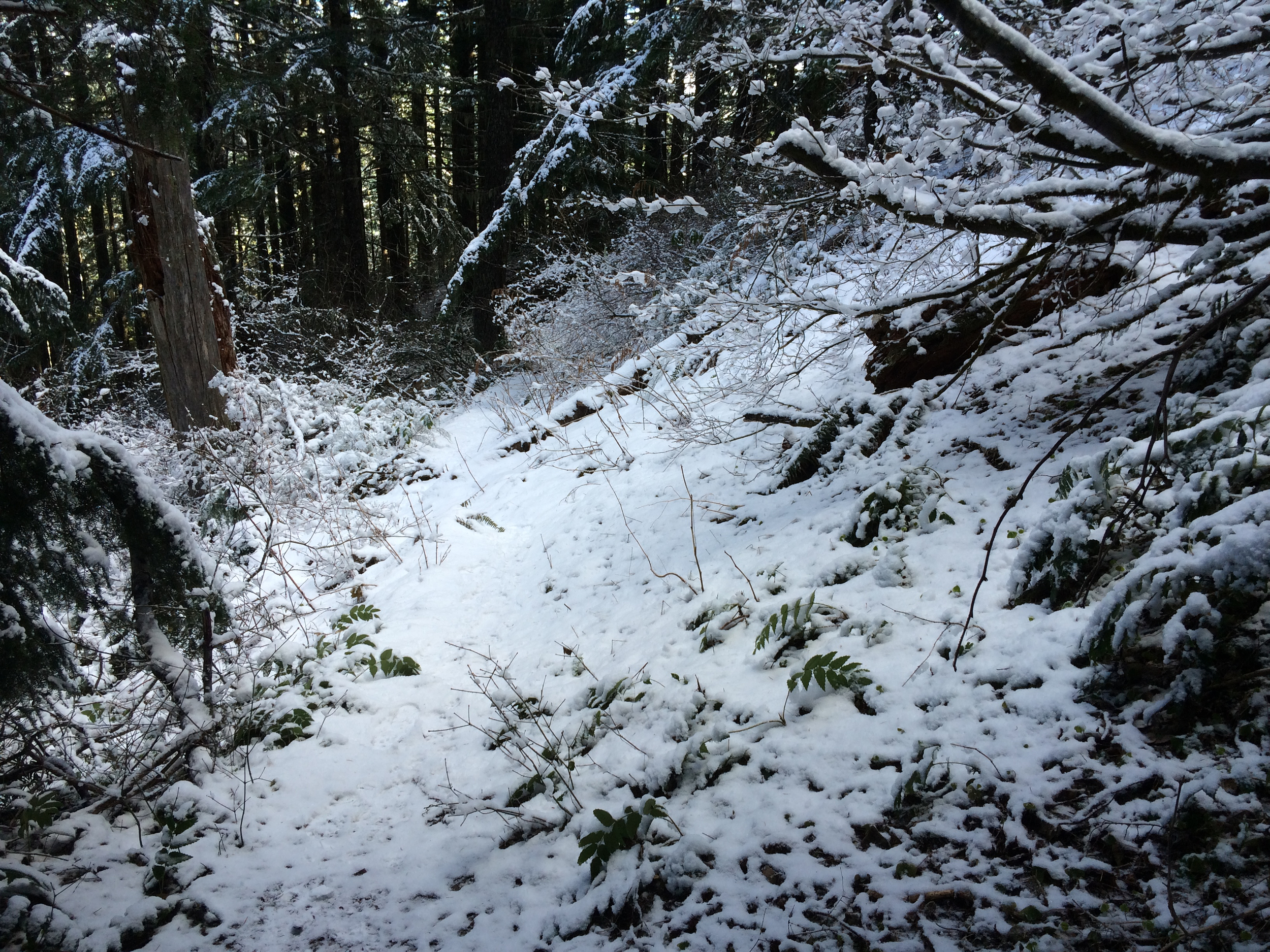
What I didn’t notice upon arriving at this point was what lay in front of us, the portion of the trail that, as Dylan would say, murders your lungs (and your legs). The rest of this hike will have you quoting Lord Of The Rings, “Up, up up the stairs we go…” or Finding Nemo, “Just keep swimming, just keep swimming,” because it is a lot of up, (a word of advice, do not do this hike in the middle of an allergy attack, your sinuses will thank you).
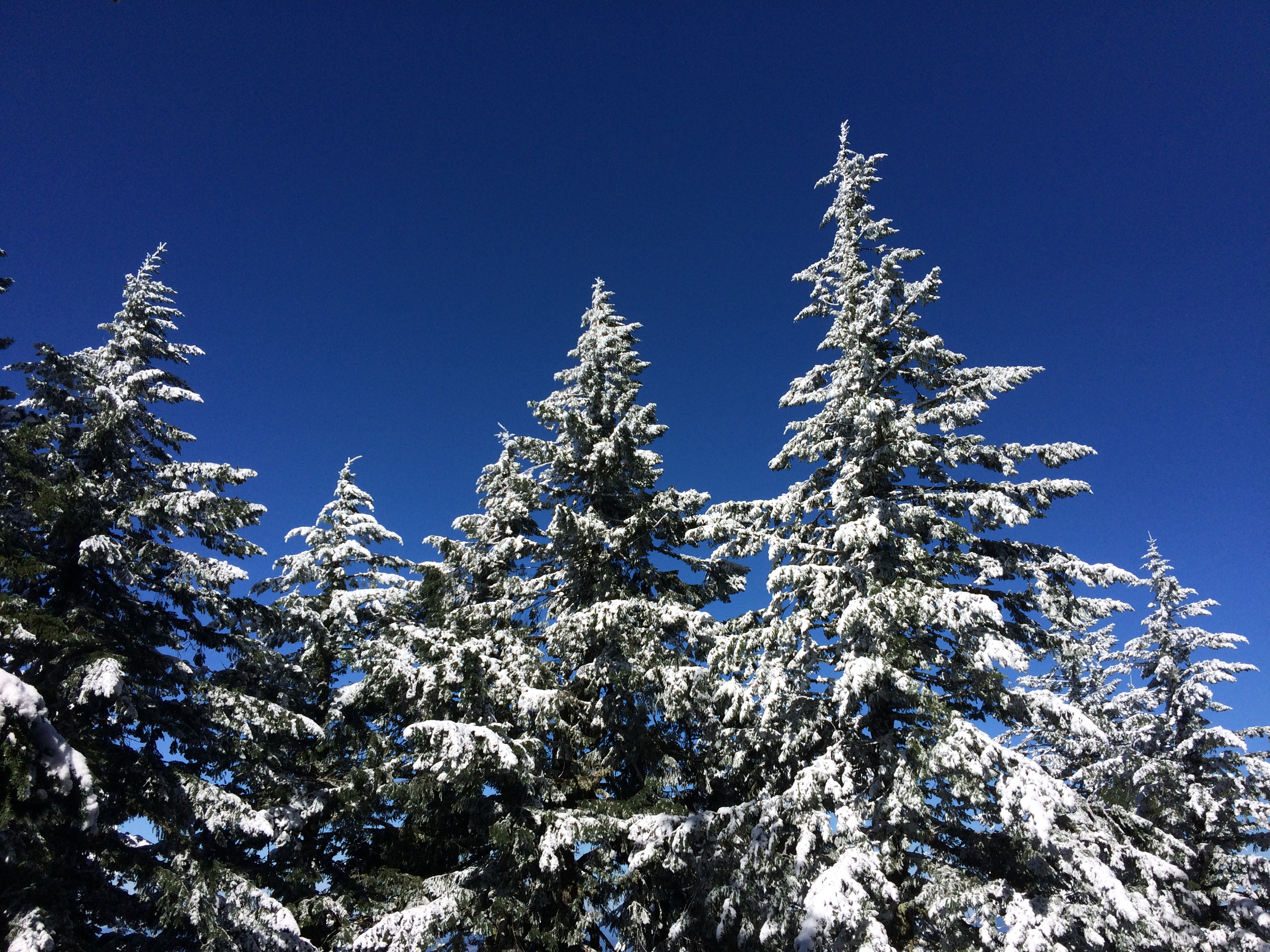
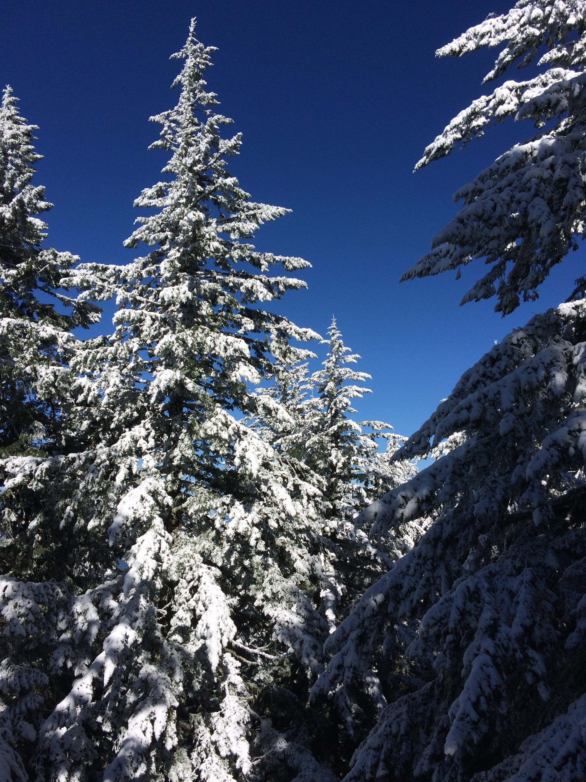
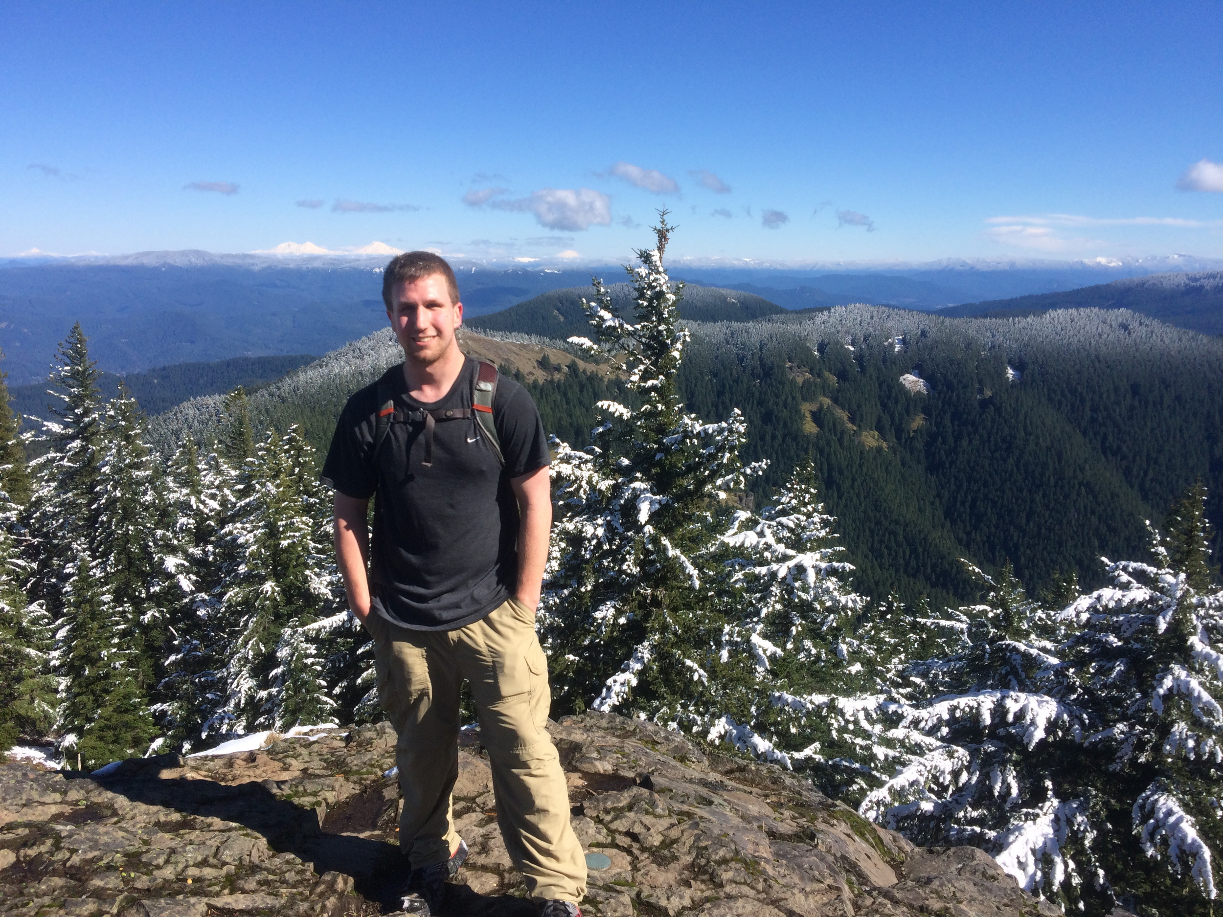
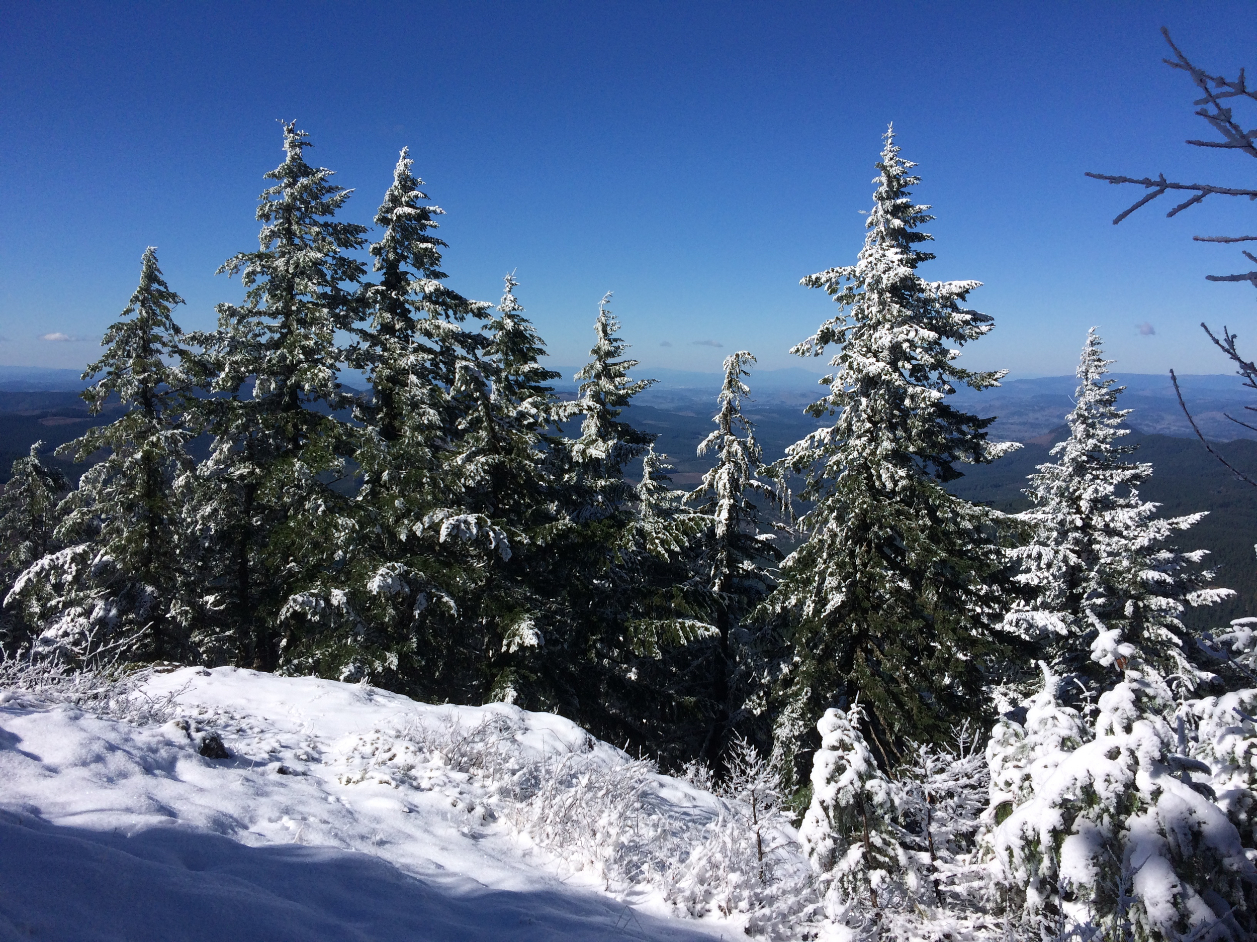
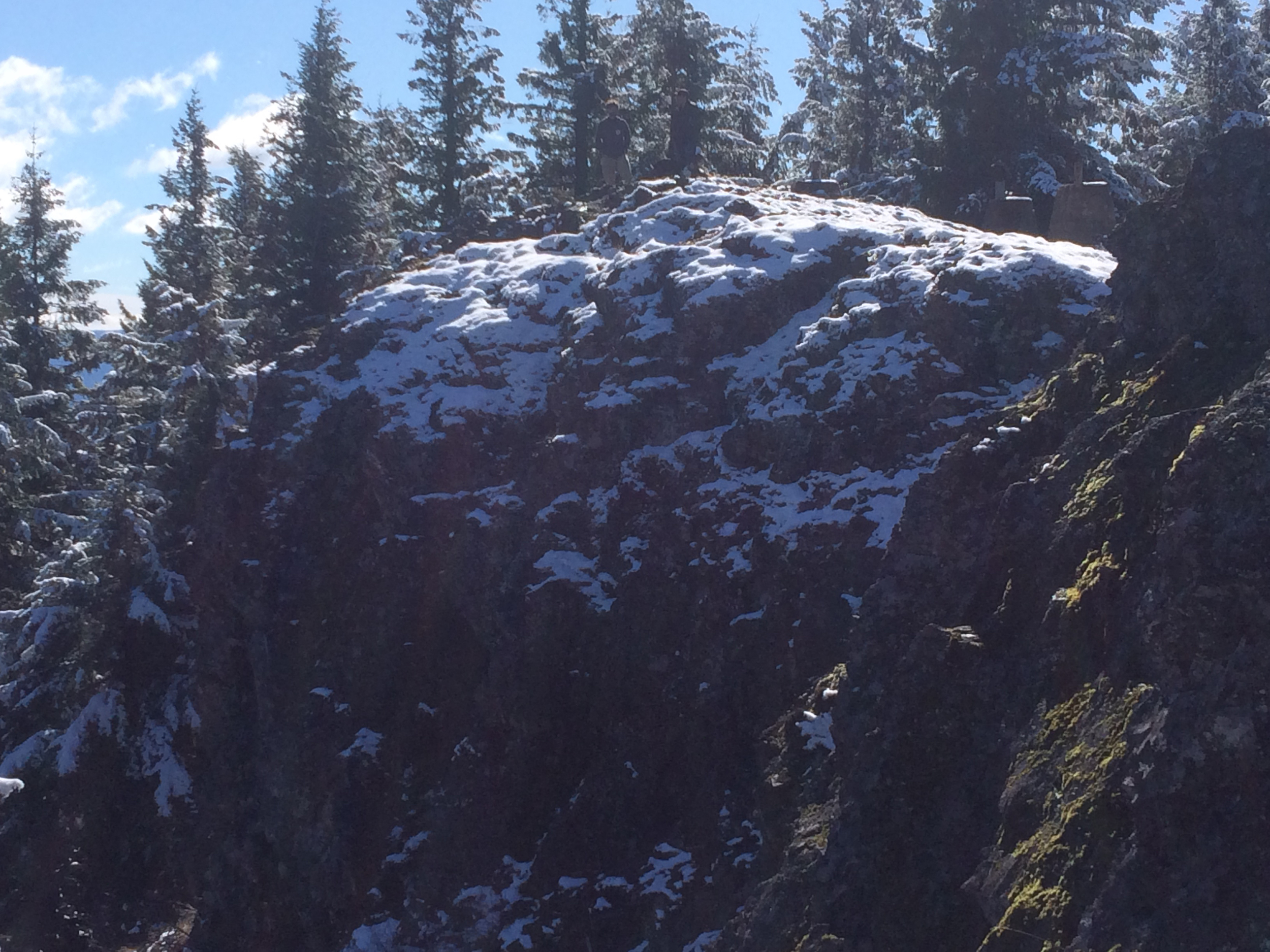
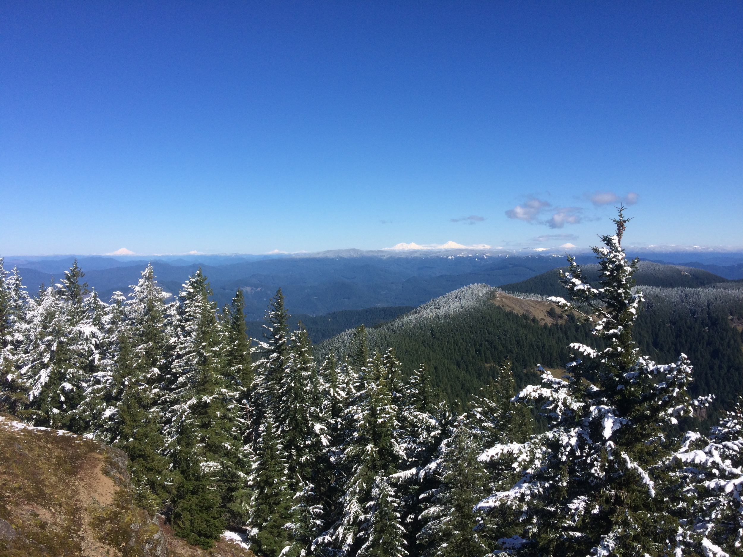
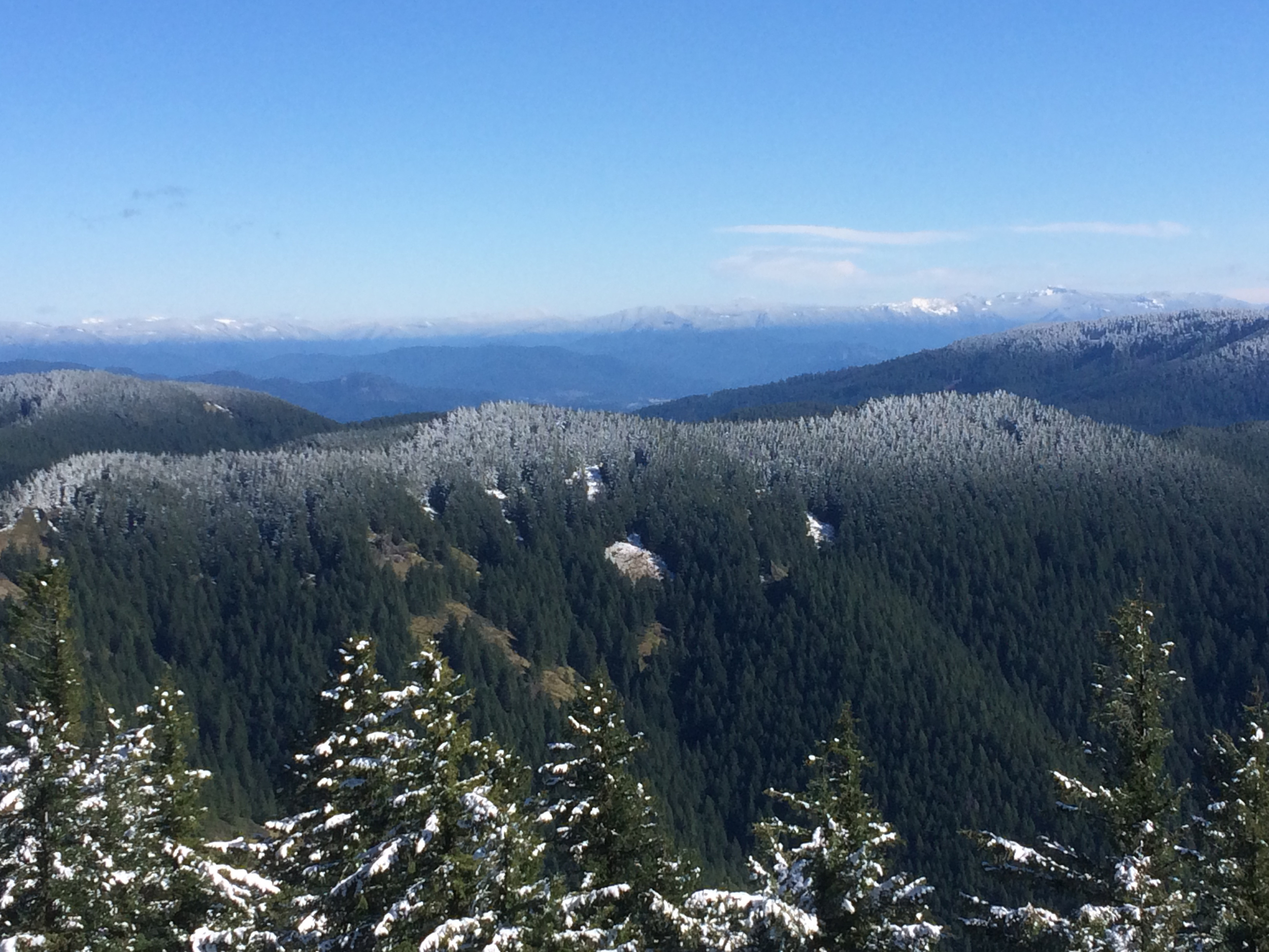
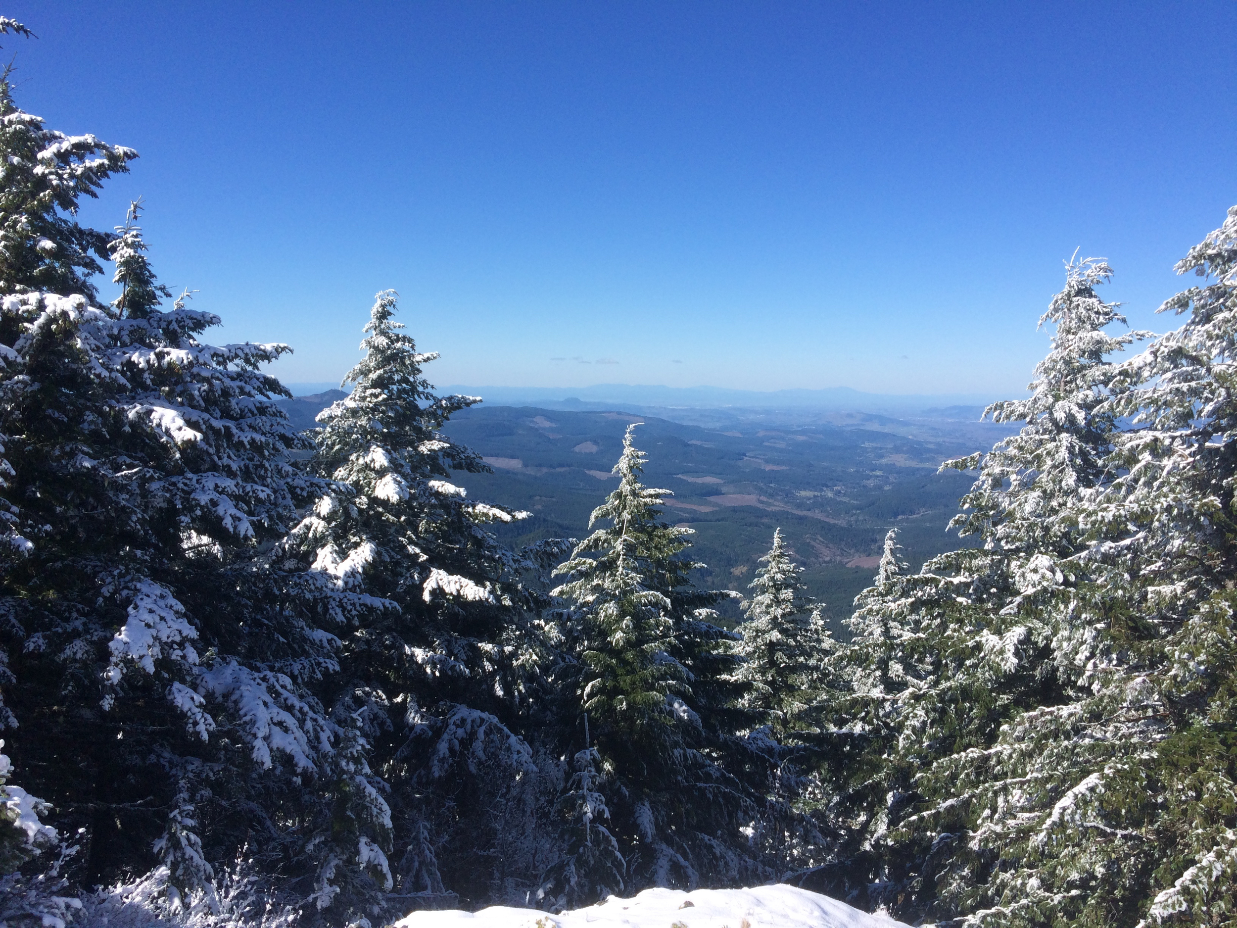
This was my first big inkling of just how conditioned Dylan is, he powered through the now 2-3 inch thick snow (sadly not enough to start a snowball fight, we tried) pretty easily while the uneven footing and altitude was starting to make its presence very known to me. This hike sent me running to the gym to get my cardio in check so that I wouldn't slow Dylan down in the future. I personally like to be able to keep up and be on even ground with him so that we can support each other on hikes. That being said, I had to stop a few times, my sea level lungs were not entirely prepared for the altitude of Mount June. But once we came out of the woods our efforts were rewarded with a beautiful view of snow capped trees, bright sun and a view into the valley below.
So Pretty!
More snow dusted trees, with Eugene in the distance.
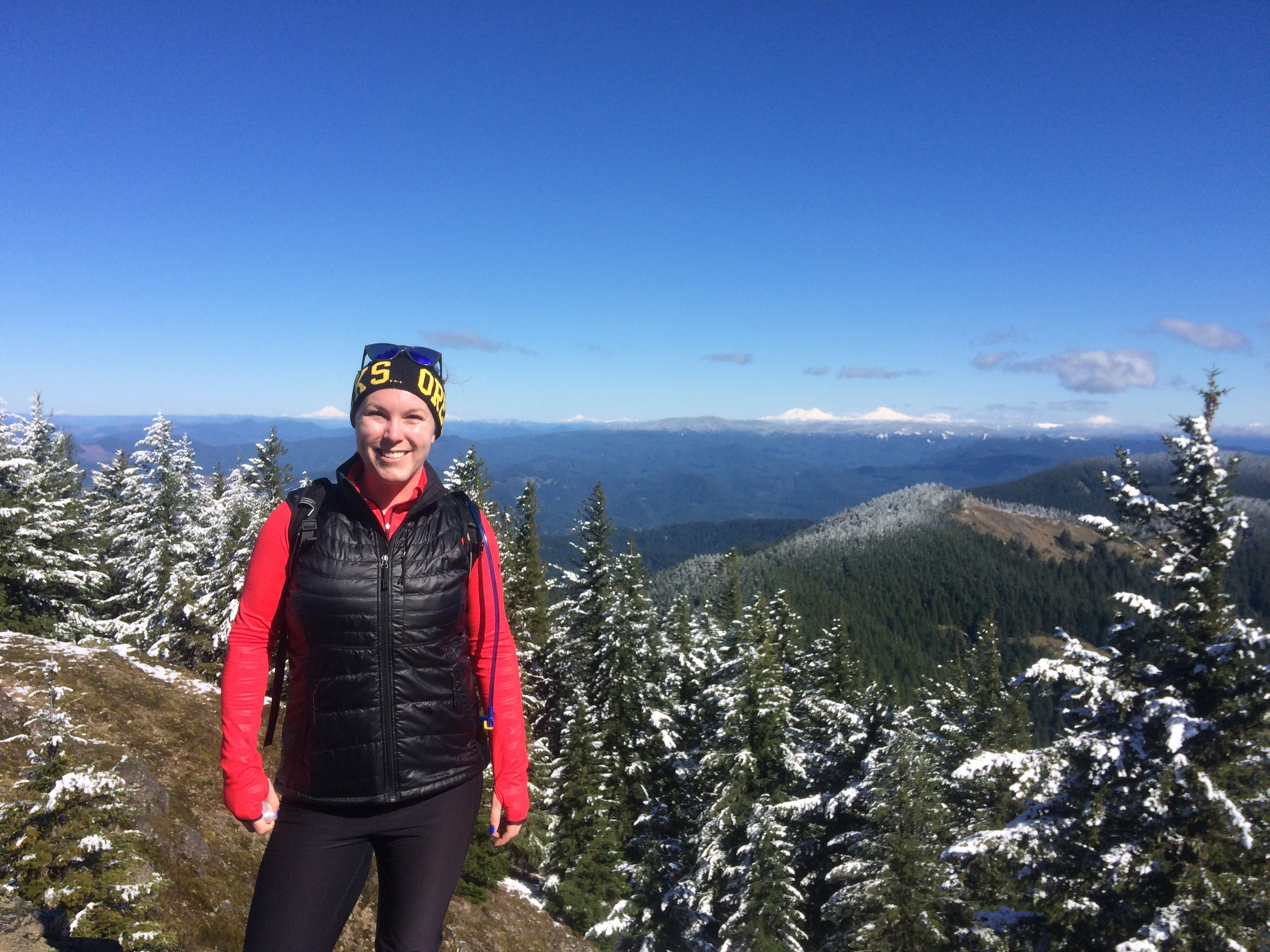
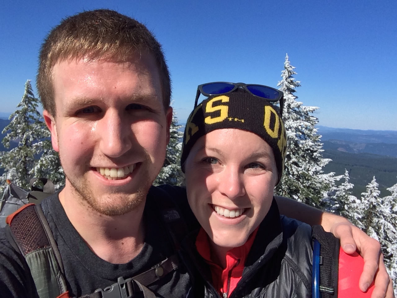
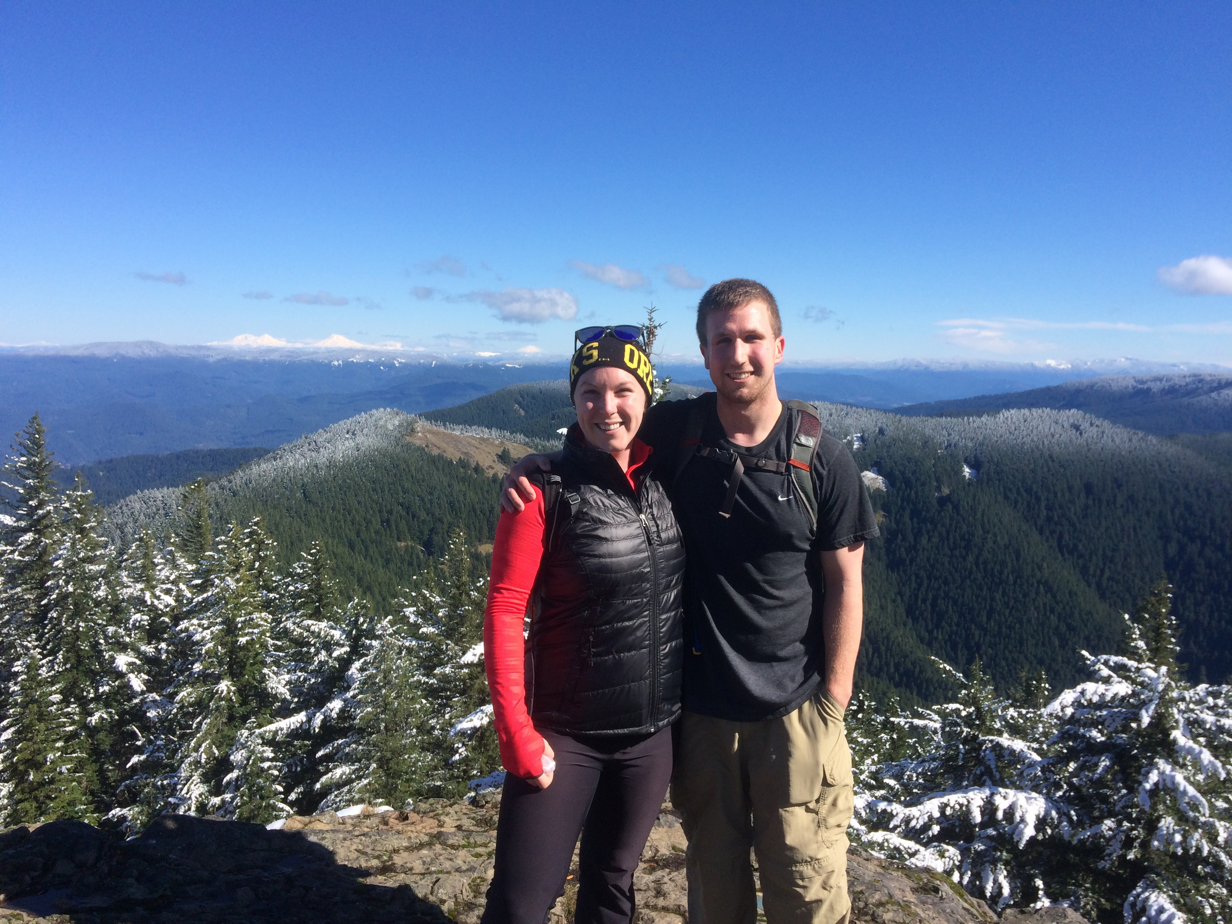
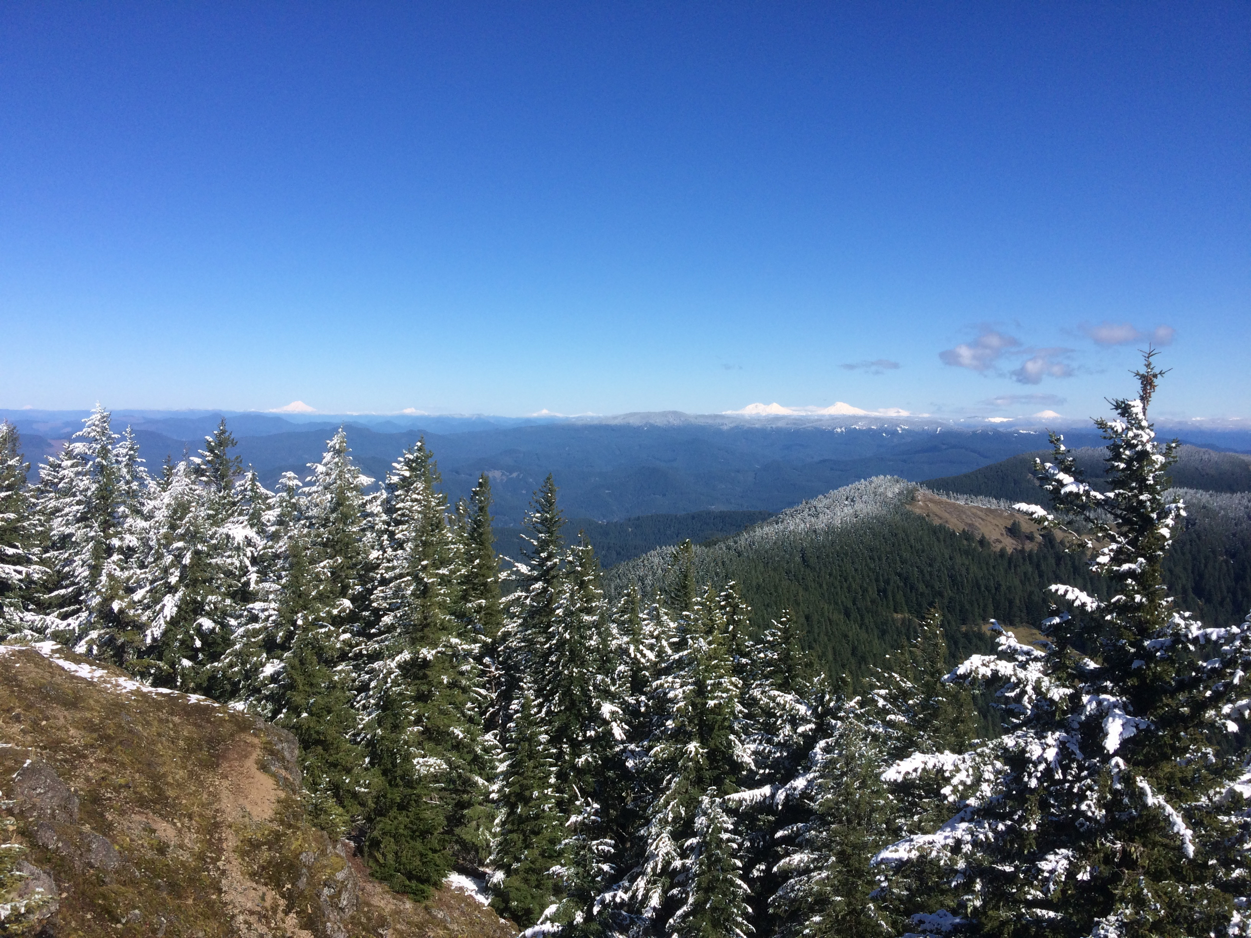
I might mention that this trail is dog friendly, at this clearing we ran into a Corgi, Australian Shepard and two Huskies, for the range of dogs we saw, they all managed the trail and now 6 inch deep snow very easily! The view at the top was spectacular, since it was a crystal clear day we could easily view Mt. Hood, Mt. Jefferson, the 3 Sisters, and Diamond Peak. At what I will call the lower summit of Mount June, if you pull out binoculars you can get a good view of Spencer’s Butte, which will look incredibly small by comparison. The summit is a great place to eat lunch before hiking back down the hill. Taking a moment to relax, enjoy the view and catch our breath was one of my favorite parts of this hike.
Three Sisters from Mount June.
Both of us at the top, note the difference in attire.
The way back down Mount June was massively entertaining, I am not sure footed in snow, thankfully my shoes have good tread and I have a partner that is conscientious of my abilities, or in this case a lack there of. I did not fall, to Dylan’s credit, he caught me several times where I would have probably face planted it in the snow. After a slow going, thigh burning, slip sliding, laughter filled, “hike” back down the hill, we made it back to the car.
Mount June on the whole, is comparable to Spencer’s Butte in difficulty (if you go up the hard way) as well as length, but with the benefit of it being less traveled and with more spectacular views. Having taken my family back on a separate occasion, without Dylan, I can vouch for the road being drastically improved and it being accessible for those who do not know the back roads of Oregon by heart.
Driving Directions
Take exit 188A off of I-5 onto Hwy 58, then drive 8.5 miles and turn right on Rattle Snake Rd (cool name right?). Follow Rattle Snake Rd for 4.4 miles, then merge right onto Lost Creek Rd (at the yield sign). Follow Lost Creek Rd for another 3.5 miles then turn Left across a narrow bridge onto Eagle's Rest Rd. Continue on Eagle's Rest Rd for 7.7 miles and stay to the left at a 'Y' intersection onto Rd 20-1-14. There is a brown hiking sign at this intersection. Stay on Rd 20-1-14 for 6.2 miles (the pavement ends after 2.7 miles) and turn left onto Rd 1721. After .1 miles take the first left onto Rd 941. Drive .4 miles on Rd 941 and watch for an unsigned trail leading uphill on the right. Parking is on a pullout on the opposite side of the road from the trailhead, we suggest getting turned around to park the right way before starting your hike (other cars may show up at the trail head, leaving less room to pull off a three point turn on the narrow road).
Map
More Photos