Sweet Creek Falls
STATS
Fitness Level: Easy
Experience Level: Easy
Distance: 2.2 out and back
Elevation: 350 feet
Open: All year
Good for: Day hiking, kids, and dogs
Usage: Heavy
Accessibility: Paved road
Quick Take
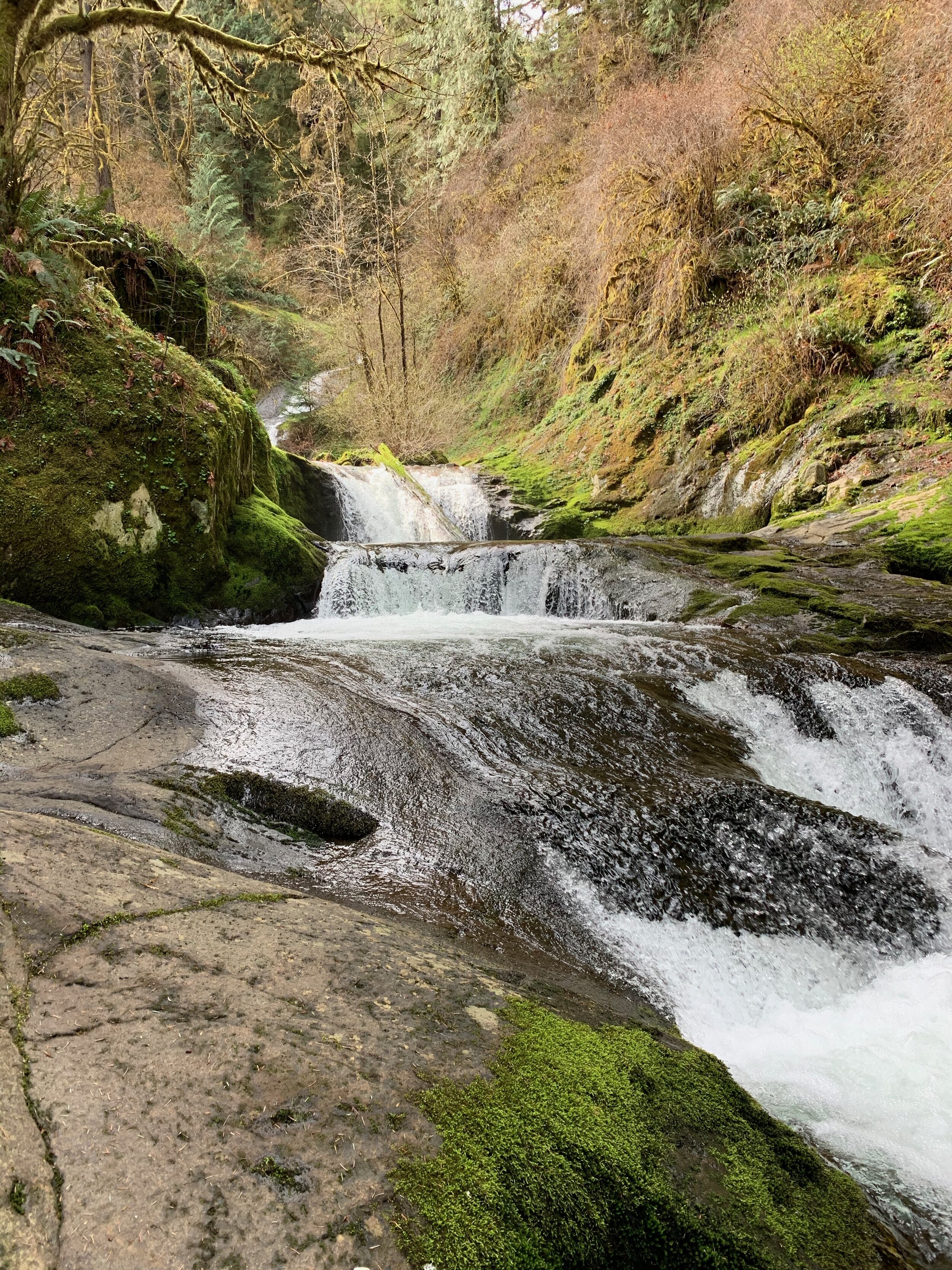
Here’s a hike that satisfies your need for adventure when you don’t have much time. Sweet Creek Falls is the perfect mini adventure covering 10 waterfalls that are accessible all year round on this relatively easy forested hike in between Florence and Eugene, OR. With a paved access road and minimal elevation gain Sweet Creek Falls is popular with hikers of all ages and experience levels.


The adventure begins
Homestead Trailhead is the first of three that access the falls. By starting here we were able to get the mild uphill portion of the hike out of the way first, and take in each of the 10 smaller falls from the best angle.

The catwalks
The cat walk esque engineering that links these waterfalls together is a truly cool engineering feet. If you have dogs with tiny paws however, they might need a ride from one end of the many cat walks to the other due to large holes in the grate.


Take your time
This is not a long hike, if you have the time, take it slow, enjoy the view and take the many side paths available on this hike. Watch your footing on these paths and make sure you have a boot with good tread! The often wet and lightly moss covered rocks are quite slippery! Our dog Porter fell into the water in one such spot at the largest of the falls.

The trail goes on for the brave…or in the summer
For those wanting to complete the trail system, there is a water crossing at the upper fall, while this would be a pretty easy crossing in the summer, in early March the creek is high, cold and moves quite quickly. It is crossable, providing you can find steady footing, and are prepared to have some cold feet.


Beaver Creek Falls
If you do manage to cross the creek the trail continues over Sweet Creek Road over to Beaver Creek Falls. If you do not make the crossing, we have good news, you can drive to this trailhead. You have two options, you can drive and re-park at the Wagon Road Trailhead for a longer hike, or do what we did and take a short gravel spur to the Upper Beaver Creek Falls Trailhead for a lazy jaunt to a view of the falls from above.
Driving Directions
Drive Highway 126 to the Siuslaw River Bridge in Mapleton (15 miles east of Florence or 46 miles west of Eugene). Cross the bridge from town and immediately turn west on Sweet Creek Road for 10.2 paved miles. Then take a paved turnoff to the right to the Homestead Trailhead turnaround.

Trail map
Green: Start of hike at Homestead Trailhead
Red: End of main hike at Sweet Creek Falls
Purple: Access to upper Beaver Falls viewpoint