Bohemia Mountain and Ghost Town
STATS
Fitness Level: Moderate
Experience Level: Difficult
Distance: 1.6 miles round trip
Elevation: 700 feet
Open: June through November
Good for: Day hiking, ruin exploring, off roading
Usage: Limited
Accessibility: 4x4 and high clearneance recommended
Quick Take
In the Cascade Foothills of Southeastern Lane County lies a land that time seems to have forgotten. Oregon's Bohemia Mining District is still the wild west, with rusty ruins, active gold mining claims, and "colorful", long bearded, locals who would be very much at home in 1890. This region's historic feel, combined with gorgeous scenery make it an awesome place for experienced adventurers to explore.
Update: Checkout our more recent trip to Bohemia Mountain via Champion Creek Road during fall color
Trip Report
Okay to be fair the title is a little misleading, not a lot remains of the once thriving gold mining community known as Bohemia City. That being said, this place is scarier than any of the real ghost towns I have visited… by far. In high school I spent several weekends there helping to dig out a collapsed mine in search of a woman who had disappeared decades ago… around the same time that her husband's mine "mysteriously" caved in, but that’s a story for a different time. The point is there are only a few areas in Lane County that legitimately creep me out, and this is one of them.
Tessa and I got a later than usual start on this trip, rolling out of my driveway around noon (I would not recommend doing that, since this is one adventure where you really want to make it back before dark). Bohemia Mountain is Southeast of Cottage Grove, Oregon, so getting there involves a short stint on I-5, followed by a scenic, if not slightly creepy, drive through the Brice Creek area. This part of Lane County is very rural, so small decaying houses with trash strewn front yards are commonplace. As Tessa and I like to say, you can really hear the banjos playing.
Eventually the blacktop ends, and things get interesting, so make sure to follow directions carefully and double check your turns with a backcountry mapping app on your phone. I have to say, it is extremely easy to get lost through here.
After climbing for a few thousand feet we encountered a breathtaking view off to the right side of the road, with Bohemia Mountain and Fairvew Lookout Tower visible in the distance. This provided an awesome photo opportunity, and a chance to get a feel for where we were headed.
A few turns later we passed by the old Musick Guard Station, and the road down to Old Bohemia City (we will get back to this later). Ahead was our biggest challenge of the trip: traversing a 0.6 mile long section of the 2460 “Road” with rocks the size of footballs, and axle cracking potholes galore. Easily traversable by a 4x4 truck, but a major challenge for my tiny Honda Civic. Thankfully, with a great deal of patience/skill, and Tessa’s encouragement, my car made it to the top like a champ.
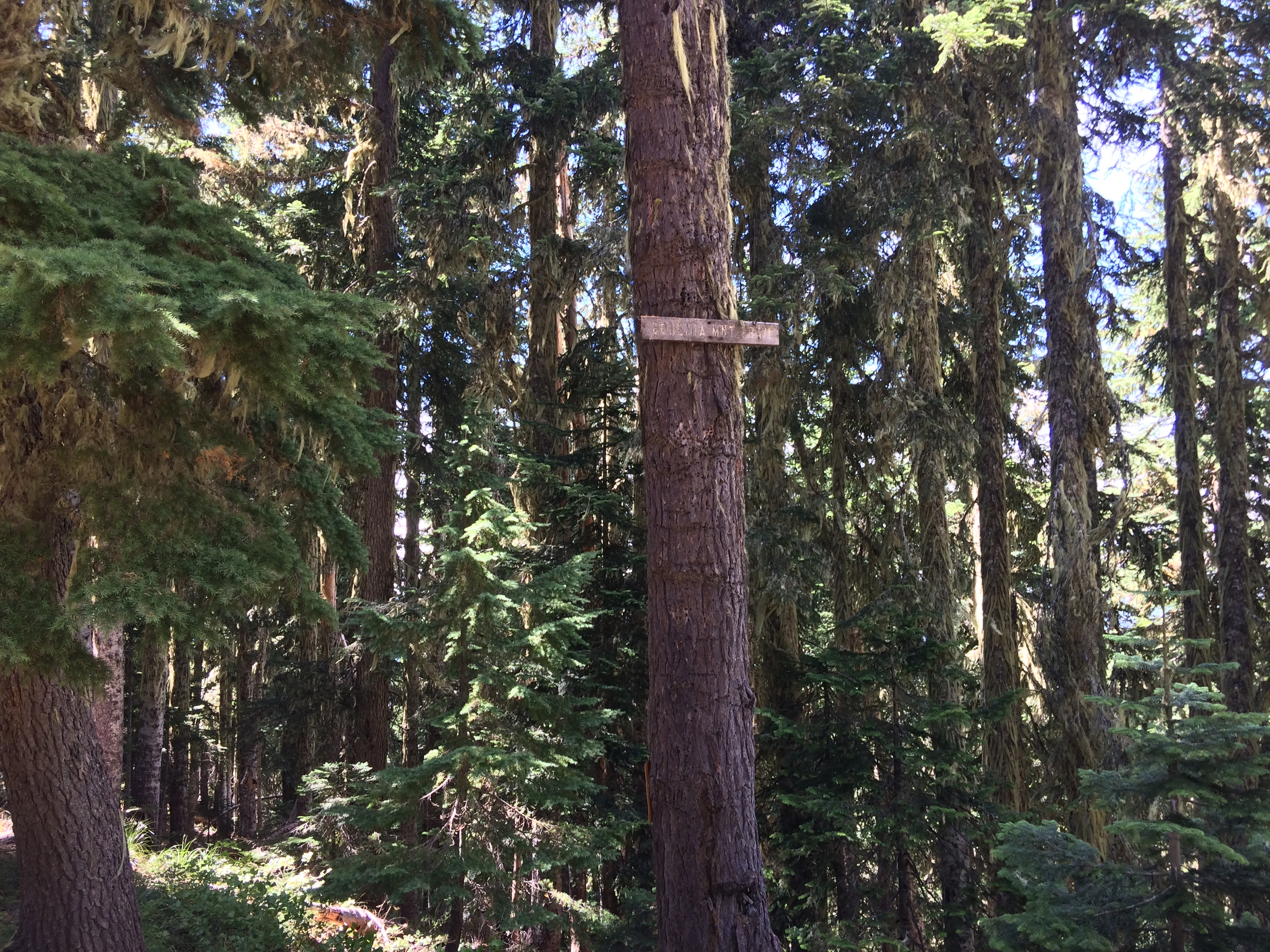
We parked in the shade at the edge of a large four road intersection. It’s worth noting that one of these roads leads up to the Fairview Lookout Tower, which can actually be rented out for one awesome camping trip with spectacular views. For this trip we took the opposite route, heading down the southernmost road from the intersection until we reached the Bohemia Mountain Trailhead on the right.
Bohemia Mountain
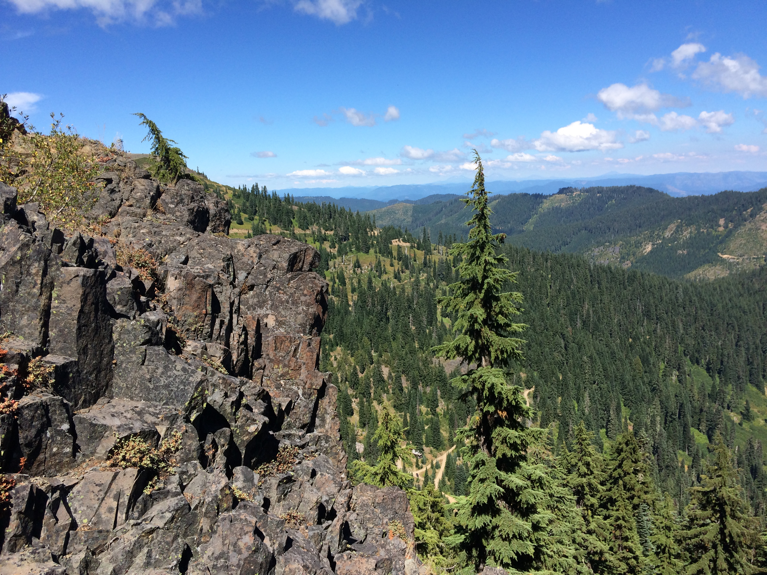
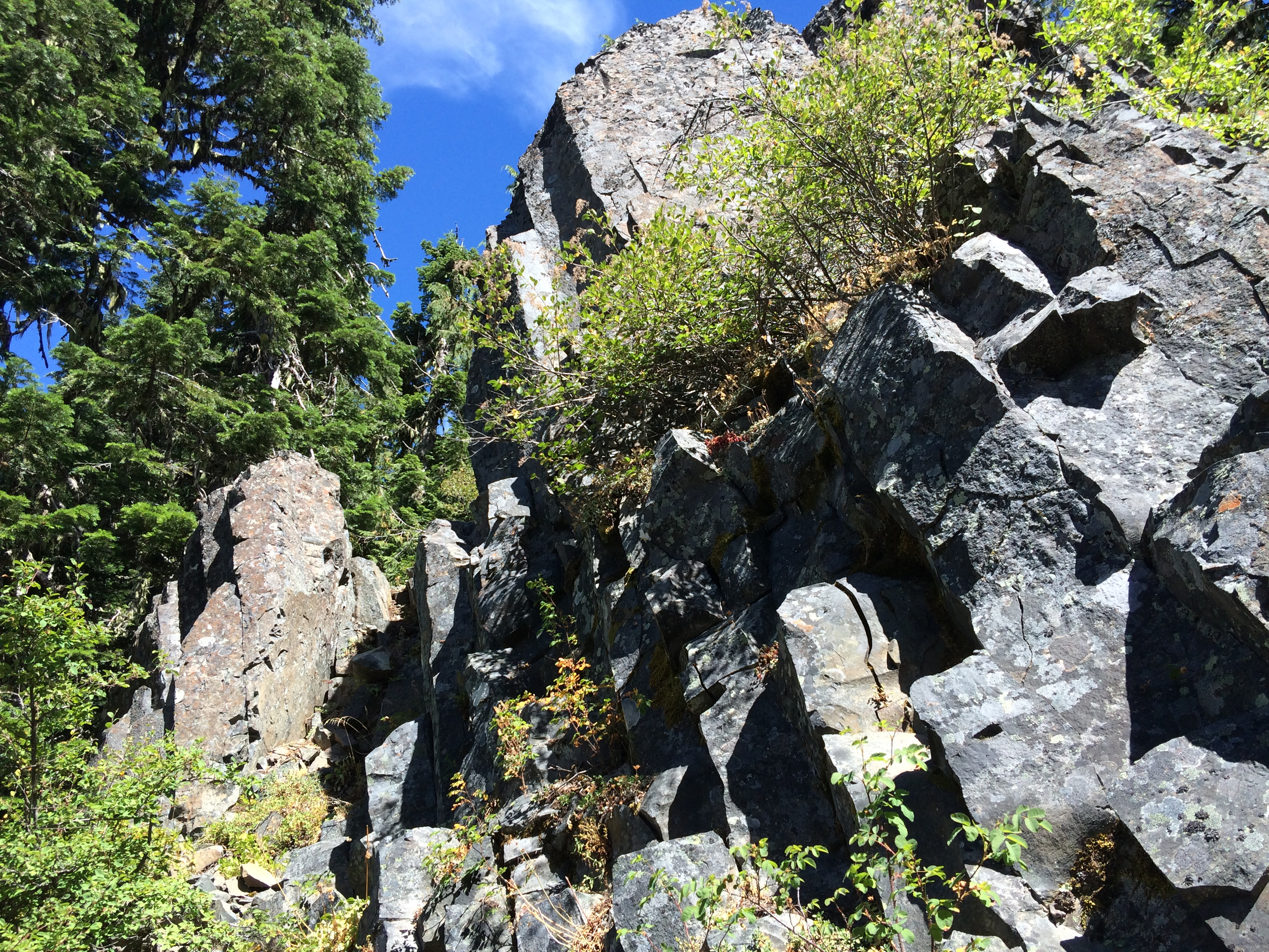
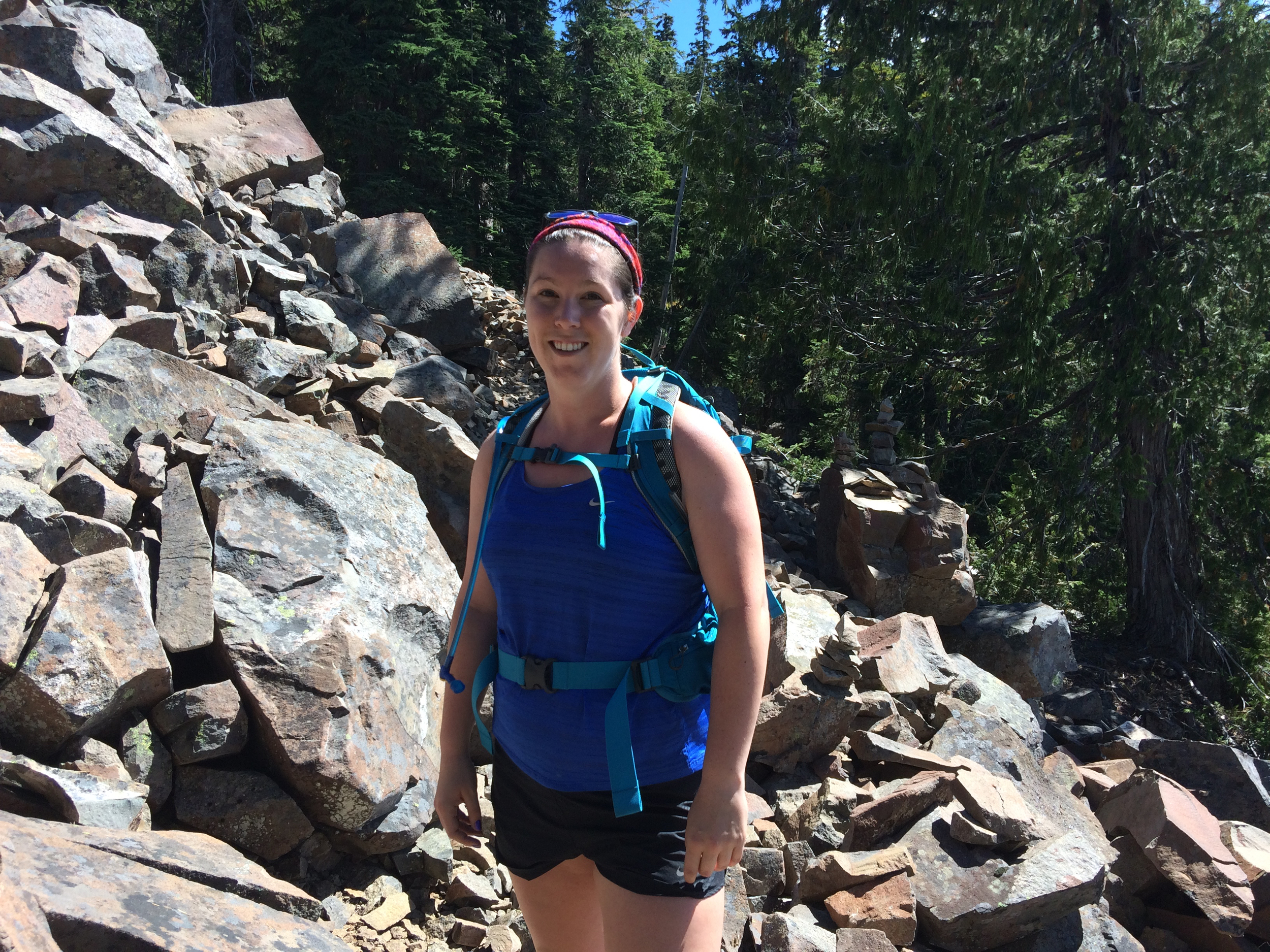
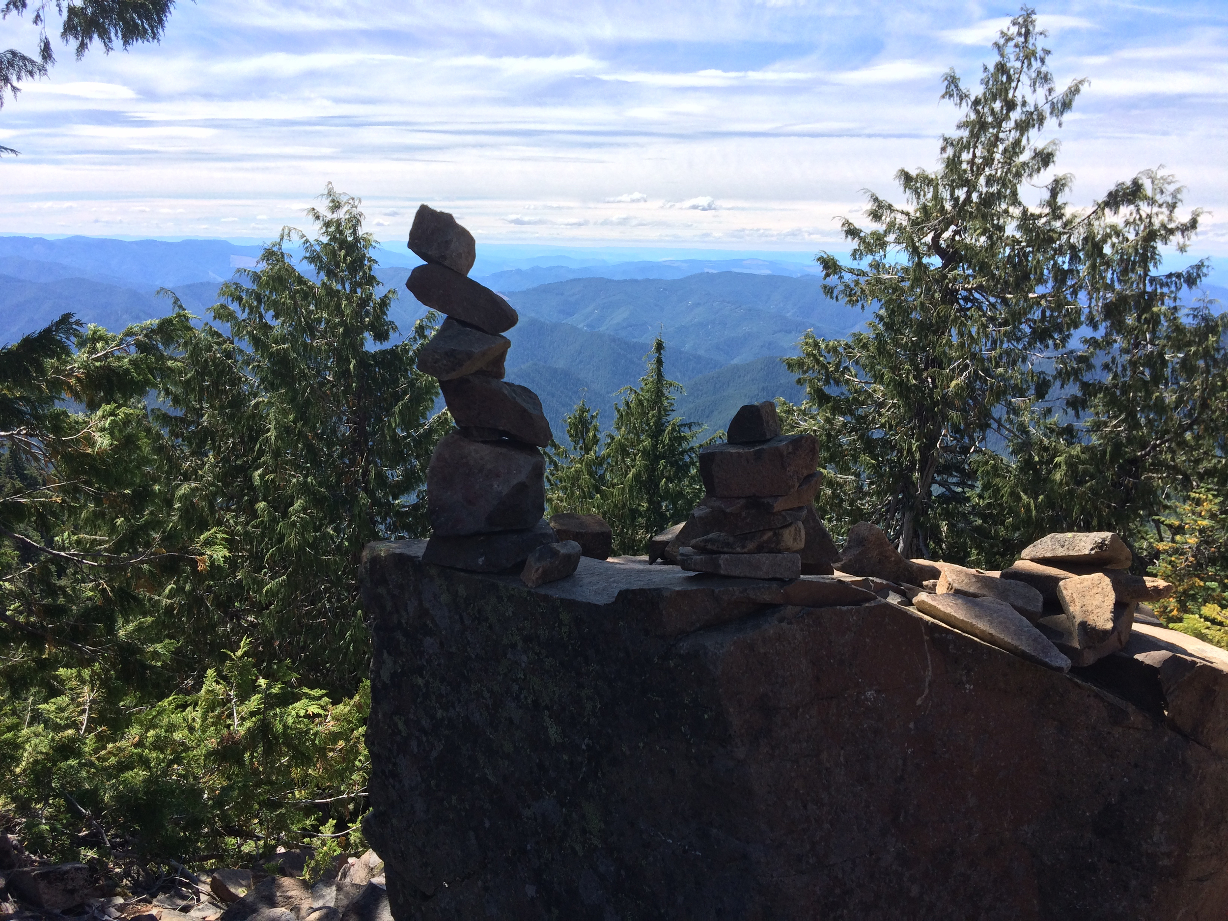
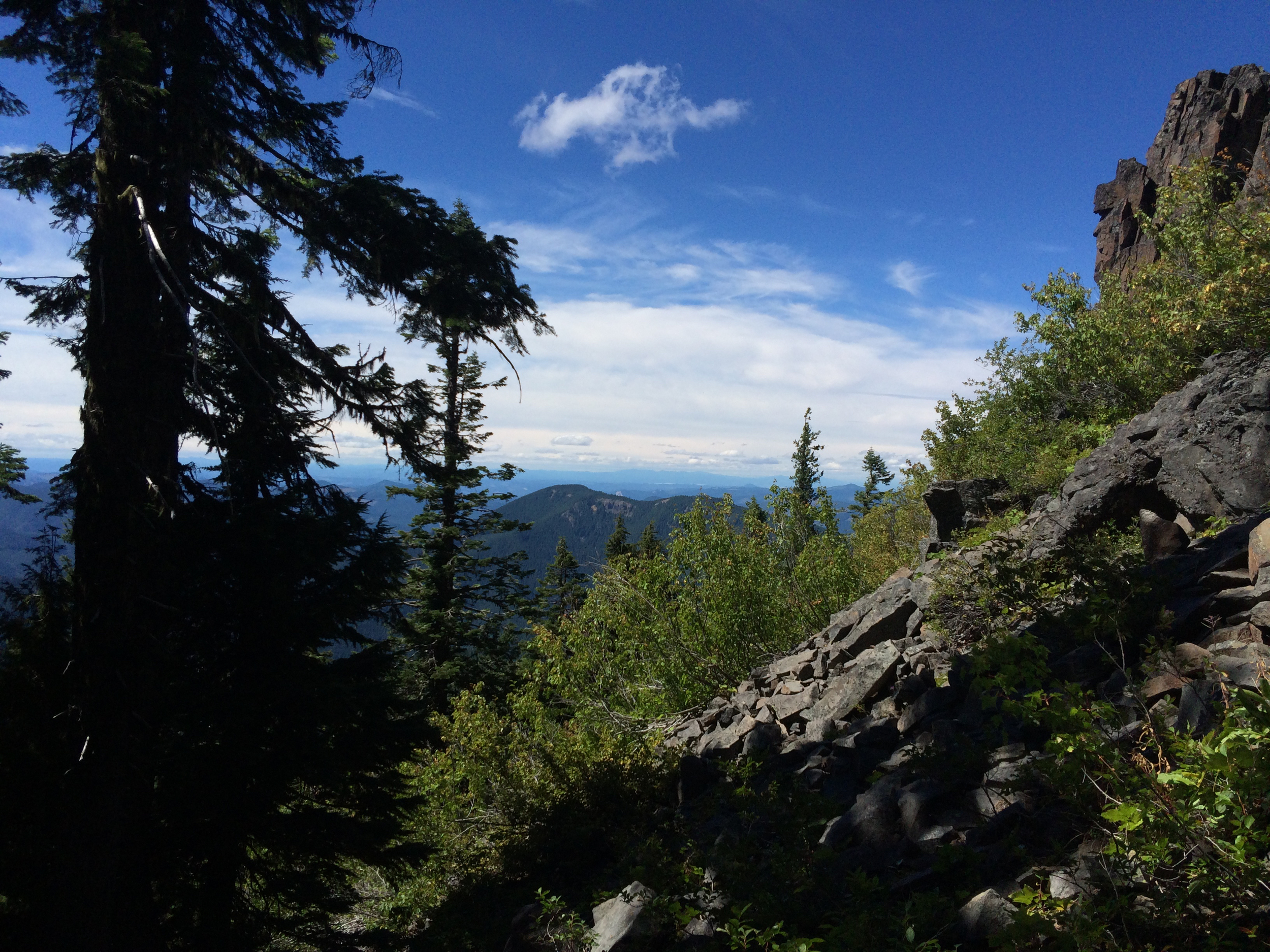
The hike up Bohemia Mountain itself is somewhere in between Spencer Butte and Mount Pisgah in difficulty, climbing 700 feet in a 1.7 mile loop. The trail was narrow at points, and some parts traversed extremely loose rocks, but overall it was easy to keep track of and not exceedingly difficult. Several false peaks offer tempting spots for photos on the way up, but none compare to the view from the top. The sky was gloriously blue for our trip, and the mountain’s “flat” rocky top offered 270 degree views which included Spencer Butte, Mount June, and Diamond Peak. I have to say, the Butte looked rather cute from Bohemia Mountain.
We took our time at the top, taking pictures of the surrounding area, hopping around rocks, and grabbing shots of us on the edge of a cliff to give our parents a scare. This was also a lovely spot to eat lunch or a snack and watch the clouds go by. As we looked around we could see/hear a variety of sketchy vehicles roaming the area on the roads below.
After capturing plenty of images we decided to head down the mountain to explore Bohemia City. The trail was substantially easier on the way back, and surprisingly the hellish section of road was as well. We made it back to Musick guard station, and I parked as far as I could on the side of the road so that we could get out and explore it. The guard station includes a small house, a creepy old horse barn, and outdoor cooking facilities. It is also available for rent to the public, and appeared to be occupied as we got closer, so we turned around out of respect for the tenants.
Bohemia City
Tessa and I walked down the moderately short road to Bohemia City. This route starts near Musick Guard Station, and heads down a slightly rough (4x4 traversable) road for half a mile to a collection of mining ruins. The most substantial of these is a stilted building to the right of the road that used to be the post office. This can be fun to explore, but be careful walking on the old, rotting, floor boards.
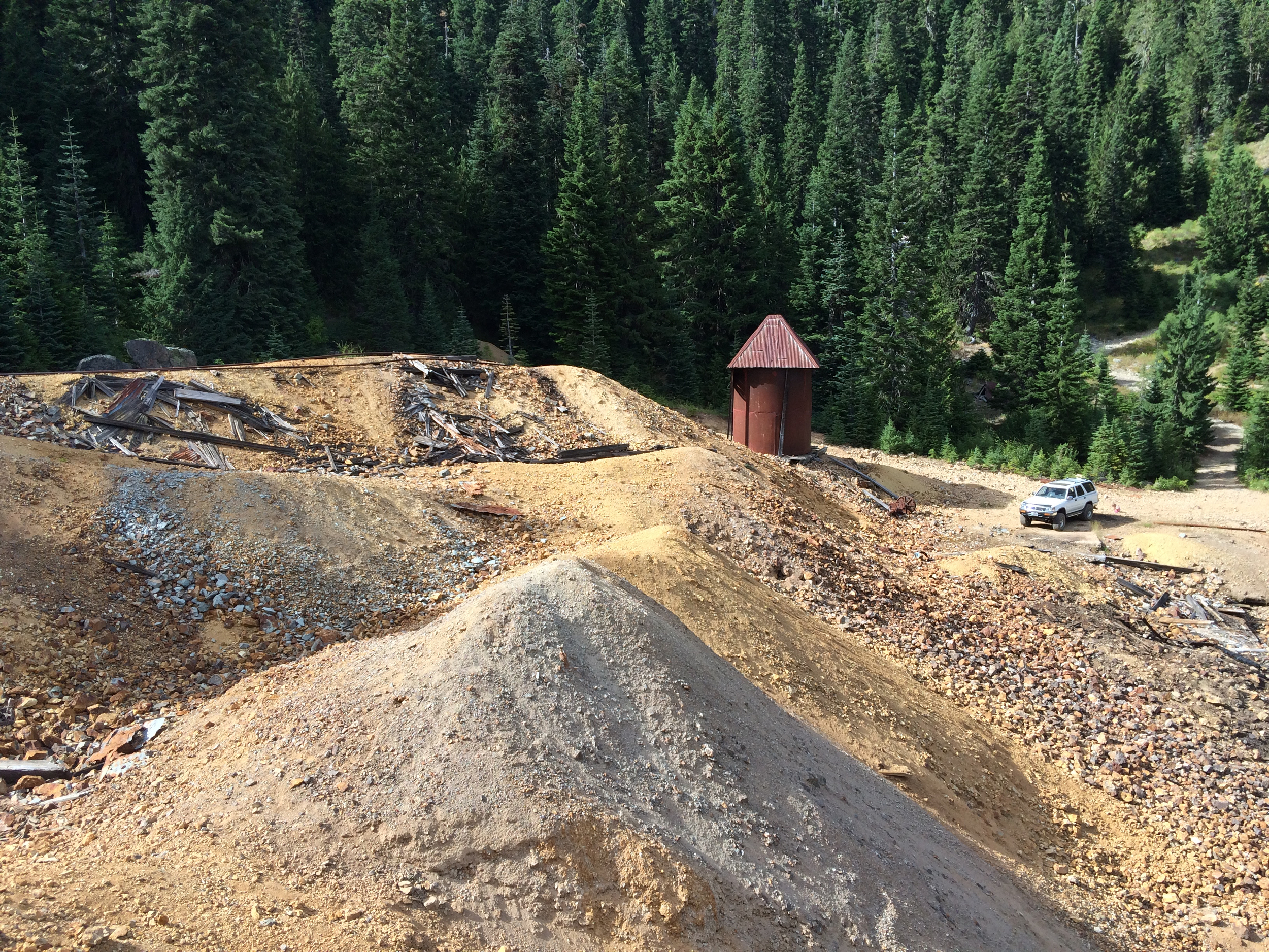
From the post office we continued towards a large pile of yellowish mine tailings. On the way we encountered a young couple with two young kids in tow (I would never bring children to this area) and the remains of what must have been a water storage silo of some sort. It was around this time that we started hearing strange pounding noises from the woods above us. I briefly caught a glimpse of a disheveled looking man with his shirt off, banging away with a hammer on something. Not wanting to find ourselves in a real life “Deliverance” sequel, we quickly moved on to explore in a different area.
The mining remains themselves were quite cool, with a massive pile of tailings (unwanted rock dug out of the mountain) and a mining cart track leading into a purposely collapsed mine shaft. A few foundations of other abandoned buildings can be found in the area, along with rusted components of massive rock crushing machines. After having our fill of pictures, Tessa and I simultaneously felt an eerie chill. We knew it was time to head. The return trip was long but thankfully uneventful. I would love to go back to Bohemia some day, just maybe with 4x4. (UPDATE: we did go back, read the post here!)
Driving Directions
Before giving driving instructions I would strongly recommend that anyone venturing to Bohemia Mountain do so in a well maintained 4x4 vehicle with high ground clearance. It is extremely easy to get lost in this area, or caught off guard by a snow storm in the winter. For those reasons you should also keep additional food,water and blankets in the trunk in case of an emergency.
From I-5, take the Cottage Grove Exit #174, turn East on Row River Road, and follow signs toward Dorena Lake. Continue on Row River Road for 20 miles to the junction with Brice Creek and Layng Creek Road. Stay to your right following Brice Creek County Road #2470 for 12 miles. Staying on Brice Creek Road, just past milepost 12, turn right onto graveled Noonday Road, #2212 following the signs to Fairview Peak and travel for 6.7 miles to the ridgeline junction of Roads #2212 and 2212-767. Stay to your right on #2212 for another 2.1 miles to Champion Saddle. From here stay to your left, entering #2460, and continue 1.1 miles to Bohemia Saddle where the road junctions with Fairview Peak Road. The trail is located at Bohemia Saddle.